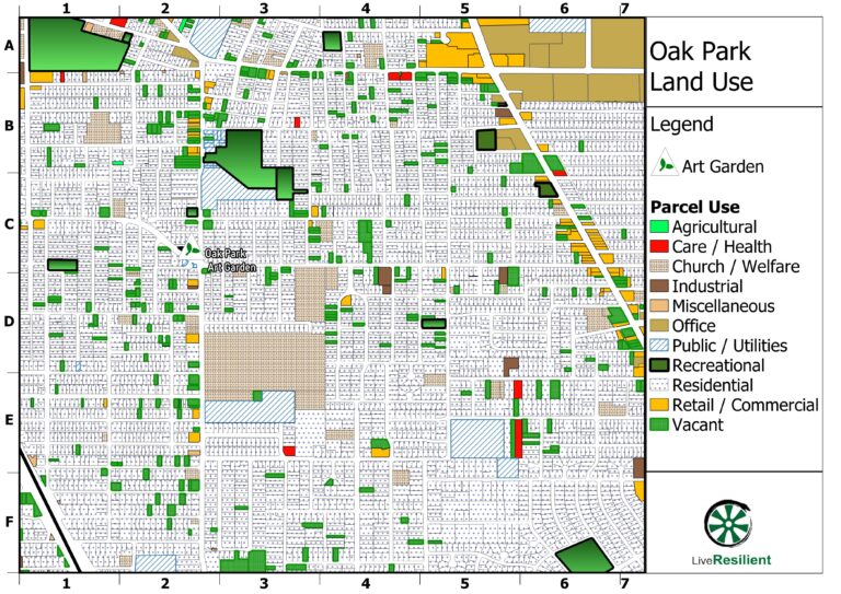
See our new Geospatial Mapping page for examples of work in drone mapping by LiveResilient.
We can use drones like the ones on that page, along with public GIS datasets or field/office research, to provide detailed views of properties and landscapes. The bulk of our work for clients and the public interest has occured in the Davis – Sacramento region.

We are available for hire, please use the Contact form here if you’d like to engage our services for your project.